Your shoreline field guide
Ruskin Commongood Park Pier
Hillsborough · pier
Call aheadSunrise to sunset, year-roundFree.
Before you go
FWC lists a public fishing pier here (survey dated 2010); the County page lists a boardwalk and dock but not the pier. Picnic shelter replacement began Sept. 3, 2026.
Hillsborough County Parks & Recreation
Hours not listed — call during business hours
Good for
Target species
Style
pierstructure
Officially listed features
free entry
From the official source linked below.
General guidance: Small pier on the Ruskin Inlet near the Little Manatee River; snook and reds use the mangrove and dock edges.
Wind & weather
Forecast from National Weather Service, updated Oct 26, 3:01 AM ET
Get Tampa Bay access, tides and red tide in your free Friday Shore Report.
We only use your email for the newsletter. Privacy policy.
The practical details
Access at a glance
| Status | Call ahead |
|---|---|
| Status note | FWC lists a public fishing pier here (survey dated 2010); the County page lists a boardwalk and dock but not the pier. Picnic shelter replacement began Sept. 3, 2026. |
| Address | 107 1st Ave. NW, Ruskin, FL 33570 |
| Hours | Sunrise to sunset, year-round |
| Parking / fees | Free. |
| Amenities | Boardwalk, Playground, Boat dock |
| Fishing license | Statewide (FWC): a Florida saltwater fishing license is required unless exempt or covered by a licensed fishing pier; a free shore-based shark fishing permit is also required to target sharks from shore, jetties, bridges and piers. Fishing license: who needs one |
Last checked Oct 2026 from Hillsborough County: Ruskin Commongood Boat Ramp
Parking
- Rates
- Free.
Source · checked Oct 26, 2026
Know the water
Fish to target here
General habitat guidance; confirm access and regulations before fishing.
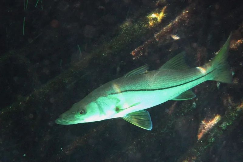
- Snook Small pier on the Ruskin Inlet near the Little Manatee River; snook and reds use the mangrove and dock edges.
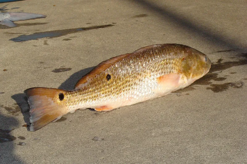
- Redfish Small pier on the Ruskin Inlet near the Little Manatee River; snook and reds use the mangrove and dock edges.
- Spotted seatrout Small pier on the Ruskin Inlet near the Little Manatee River; snook and reds use the mangrove and dock edges.
Tide chart, next 48 hours
7-day high/low table
Station: Little Manatee River, US 41 Bridge (8726436) · 1.9 km away. Heights in feet above MLLW; station local time (EST/EDT). Predictions are not observed conditions.
| Date / time | Tide | Feet |
|---|---|---|
| 2026-10-26 02:41 | High | 2.134 |
| 2026-10-26 10:24 | Low | -0.405 |
| 2026-10-26 17:36 | High | 1.319 |
| 2026-10-26 20:51 | Low | 1.204 |
| 2026-10-27 03:12 | High | 2.327 |
| 2026-10-27 11:10 | Low | -0.544 |
| 2026-10-28 03:47 | High | 2.46 |
| 2026-10-28 11:58 | Low | -0.581 |
| 2026-10-29 04:26 | High | 2.509 |
| 2026-10-29 12:48 | Low | -0.52 |
| 2026-10-30 05:10 | High | 2.457 |
| 2026-10-30 13:43 | Low | -0.378 |
| 2026-10-31 06:00 | High | 2.3 |
| 2026-10-31 14:44 | Low | -0.188 |
| 2026-11-01 06:02 | High | 2.054 |
| 2026-11-01 14:50 | Low | 0.02 |
Red tide (FWC samples, last 8 days)
No FWC samples within 15 km in the last 8 days.
Samples are point-in-time observations; missing samples do not establish safe conditions. Check FWC’s current report.
Sources
OpenClosedCall ahead
Map requires an internet connection. Spot details are listed below.
Spot a change? Email [email protected]
Get the Friday Shore Report
Which Tampa Bay piers and shore spots are open, plus tides and red tide, every Friday. Free.
We only use your email for the newsletter. Privacy policy.
No spam. Unsubscribe anytime.